


Atlanta’s Interstate 285, affectionately (or perhaps notoriously) known as “The Perimeter,” has earned a troubling distinction over the years: it consistently ranks among America’s deadliest highways. This 63-mile loop encircling Georgia’s capital city was designed to alleviate traffic congestion, but instead, it has become a treacherous corridor that claims lives and causes countless injuries each year. For Georgia residents and visitors alike, understanding why this highway maintains such a dangerous reputation is crucial for both safety awareness and legal preparedness.
The Statistical Reality of I-285’s Danger
The reputation of I-285 as one of America’s most dangerous highways isn’t merely anecdotal—it’s supported by hard data. According to the National Highway Traffic Safety Administration (NHTSA) and Georgia Department of Transportation (GDOT) statistics, I-285 regularly records fatality rates significantly higher than national averages for similar interstate highways.
Between 2015 and 2023, I-285 averaged approximately 3.5 fatal crashes per 10 miles annually—approximately 75% higher than the national average for urban interstates. In recent years, certain segments have recorded even more alarming statistics. The stretch between I-20 on the west side and Georgia 400 has been particularly deadly, with accident rates nearly double those of comparable highway sections nationwide.
But what specific factors contribute to making this highway so consistently dangerous year after year? The answers lie in a complex interplay of design, usage patterns, and distinct regional characteristics.
Design Limitations and Historical Context
When I-285 was initially designed in the 1960s, Atlanta’s metropolitan population was approximately 1.5 million people. Today, the metro area serves over 6 million residents. This dramatic population growth has placed immense pressure on infrastructure that wasn’t designed for current traffic volumes.
Several design features of I-285 contribute to its danger:
1. Closely Spaced Interchanges
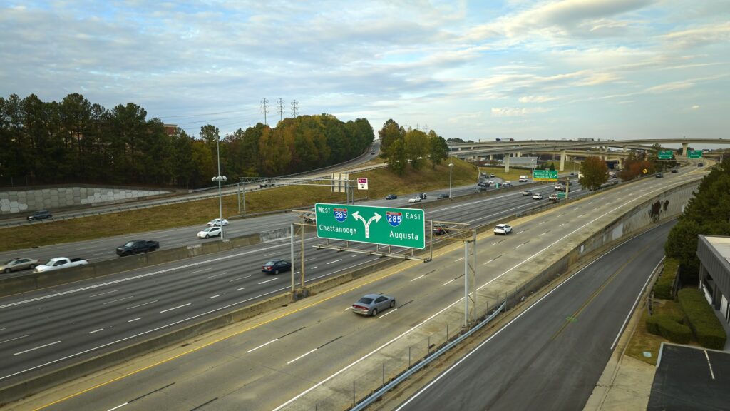
I-285 features interchanges with major highways and local roads spaced as little as one mile apart in some sections. This creates dangerous merging situations where drivers must navigate both entering and exiting traffic simultaneously. The interchanges with I-75, I-85, I-20, and GA-400 are particularly problematic, creating what traffic engineers call “weaving sections” where cars must cross multiple lanes in short distances.
2. Varying Lane Configurations
The highway changes from 4 lanes to 8 lanes in different sections, creating bottlenecks where traffic must compress. These transition points become high-risk areas for rear-end collisions, especially during peak congestion periods.
3. Inadequate Shoulder Space
Many sections of I-285, particularly on older overpasses and bridges, have minimal shoulder space. This means disabled vehicles have nowhere safe to pull off, creating hazardous obstacles in active traffic lanes.
4. Aging Infrastructure
Despite ongoing improvements, portions of I-285 still utilize infrastructure from its original construction. Older ramps feature tighter curves and shorter acceleration/deceleration lanes than modern safety standards would recommend.
Unique Traffic Patterns and Usage
Beyond physical design, how I-285 is used contributes significantly to its danger:
1. The Mix of Local and Through Traffic
As both a bypass for long-distance travelers and a daily commuter route, I-285 must accommodate vastly different driving behaviors. Long-haul truckers, local commuters, and out-of-town visitors share the same lanes despite having different destinations, speeds, and levels of familiarity with the road.
2. Unprecedented Truck Volume
I-285 serves as a critical freight corridor, with commercial trucks accounting for approximately 20% of its daily traffic—double the national average for urban highways. The Port of Savannah’s growth has further increased truck traffic, as goods move between the port and distribution centers throughout the Southeast. These large vehicles have longer stopping distances and larger blind spots, increasing risk factors for all motorists.
3. Complex Commuter Patterns
Unlike many cities where traffic primarily flows into and out of a central business district, Atlanta has multiple major commercial centers dispersed around the metropolitan area. This creates complex commuting patterns where heavy traffic flows in multiple directions simultaneously during peak hours. Major employment centers in Perimeter Center, Cumberland, and Hartsfield-Jackson Airport all generate significant traffic on different segments of I-285.
4. Speed Differential Issues
Georgia law allows trucks to travel at a maximum of 65 mph on I-285, while passenger vehicles can legally drive 70 mph. However, actual speeds vary dramatically based on congestion and driver behavior. During lighter traffic periods, speed surveys have found passenger vehicles frequently exceeding 80 mph, while trucks maintain lower speeds. This speed differential creates dangerous passing situations.
Weather and Environmental Factors
Georgia’s climate and environmental conditions also play roles in I-285’s safety profile:
1. Sudden Severe Weather Events
Atlanta’s geographic location makes it prone to rapid weather changes. Pop-up thunderstorms are common, especially during summer months, creating sudden downpours that dramatically reduce visibility. Unlike highways in the Midwest with long sight lines, I-285’s curves and elevation changes mean drivers often have little warning before encountering these dangerous conditions.
2. Sun Glare Issues
Portions of I-285, particularly the east and west segments, align with the rising and setting sun during peak commute hours at certain times of year. This creates dangerous sun glare conditions where drivers may be temporarily blinded while traveling at high speeds.
3. Vegetation Management Challenges
Georgia’s long growing season and abundant rainfall create constant vegetation management challenges. Without regular maintenance, roadside vegetation can quickly obscure signage and reduce visibility at entrance and exit ramps. GDOT must maintain an aggressive cutting schedule to prevent these issues.
The Human Element: Driver Behavior on I-285
Perhaps the most significant factor in I-285’s danger is how people drive on it:
1. The “Perimeter Paradox”
Traffic psychology researchers have noted what some call the “Perimeter Paradox”—a phenomenon where regular I-285 commuters develop both overconfidence and heightened anxiety. Long-time users of the highway often take risks based on familiarity, while simultaneously driving defensively out of experience with its dangers. This creates unpredictable driver behavior.
2. Aggressive Lane Changes
GDOT studies have found that lane changes on I-285 occur at approximately twice the rate of other Georgia interstates. The complex exit patterns and severe congestion incentivize drivers to weave between lanes seeking faster routes, each movement increasing collision risk.
3. Distracted Driving Hotspot
Georgia’s Hands-Free Law went into effect in 2018, prohibiting drivers from holding phones while driving. However, enforcement data shows I-285 remains a hotspot for distracted driving citations. The stop-and-go nature of traffic creates situations where drivers are tempted to check devices during slowdowns, then fail to return full attention when traffic speeds up.
4. Speeding During Off-Peak Hours
The congestion that plagues I-285 during daytime hours often gives way to wide-open roads late at night. This dramatic contrast leads some drivers to excessive speeds during overnight hours. Georgia State Patrol data indicates that the most severe accidents on I-285 often occur between 11 PM and 5 AM, when speeds are highest despite reduced visibility.
Legal Implications for Accidents on I-285
For those who have been involved in accidents on I-285, several unique legal considerations come into play:
1. Jurisdictional Complexity
I-285 passes through multiple jurisdictions including Fulton, DeKalb, Cobb, and Clayton counties. This can create complexity in determining which law enforcement agencies respond and which local courts may handle resulting cases. Accident reports may need to be obtained from different agencies depending on the precise location of the incident.
2. Municipality-Specific Ordinances
Different municipalities along I-285 may have specific traffic ordinances that can affect liability determinations. For example, some jurisdictions have additional restrictions on lane usage for commercial vehicles or specific requirements for hazard light activation during slowdowns.
3. Enhanced Commercial Vehicle Regulations
The high volume of commercial traffic on I-285 means many accidents involve professional drivers subject to Federal Motor Carrier Safety Administration (FMCSA) regulations. These cases involve additional layers of compliance investigation, including hours-of-service logs, maintenance records, and corporate safety policies.
4. Infrastructure Liability Considerations
In some I-285 accidents, questions of infrastructure maintenance and design may become relevant to liability. Georgia law does allow for potential government liability in cases where road design or maintenance issues contributed to accidents, though these claims must navigate sovereign immunity provisions and face strict notice requirements.
Recent and Ongoing Safety Improvements
To address I-285’s persistent safety issues, Georgia has implemented and continues to develop several significant initiatives:
1. The Transform 285/400 Project
This major infrastructure project has redesigned one of the most dangerous interchanges on I-285 where it meets Georgia 400. The improvements include collector-distributor lanes to separate merging traffic from through traffic, reducing dangerous weaving movements.
2. Variable Speed Limit Implementation
Portions of I-285 now feature variable speed limit signs that can adjust posted speeds based on congestion, weather conditions, and accidents. This technology aims to reduce the dangers of speed differentials by creating more consistent traffic flow.
3. Enhanced Enforcement Zones
Georgia State Patrol has designated specific high-risk segments of I-285 as enhanced enforcement zones, with increased trooper presence and automated speed detection technology. These zones focus particularly on the top end perimeter between I-75 and I-85.
4. Wrong-Way Driver Prevention Systems
Following several deadly wrong-way driver incidents, GDOT has installed enhanced wrong-way detection and warning systems at key I-285 interchanges, using thermal cameras and flashing warning lights to alert drivers who enter ramps in the wrong direction.
5. Future Express Lanes
The Georgia DOT’s Major Mobility Investment Program includes plans for new express lanes along the top end of I-285. These lanes aim to provide more reliable trip times and reduce congestion in general-purpose lanes, potentially decreasing the accident-inducing stress that contributes to dangerous driving behaviors.
Practical Safety Advice for I-285 Drivers
For those who must navigate I-285, consider these safety recommendations based on the highway’s specific risk factors:
- Allow Extra Following Distance: The unpredictable stop-and-go nature of I-285 traffic requires greater following distances than you might normally maintain. The 3-second rule should be extended to 4 or 5 seconds.
- Plan Lane Positions Early: Knowing your exit in advance and positioning yourself properly can eliminate dangerous last-minute lane changes. GPS navigation with lane guidance can be particularly helpful on I-285.
- Be Particularly Alert at Major Interchanges: The sections where I-285 meets I-20, I-75, I-85, and GA-400 require heightened awareness. These areas feature complex lane splits and heavy merging traffic.
- Consider Alternative Routes During Peak Hours: For local trips, surface streets may actually provide safer and faster alternatives during the heaviest congestion periods, typically 7-9 AM and 4-7 PM.
- Maintain Situational Awareness Around Commercial Vehicles: Give trucks extra space, particularly when they’re changing lanes or navigating interchanges. Remember that if you can’t see their mirrors, their drivers can’t see you.
Conclusion: Respecting the Perimeter’s Risks
I-285’s dangerous reputation is built on a complex interplay of design challenges, traffic patterns, and human behavior. While infrastructure improvements continue to address physical aspects of the highway, each driver’s decisions ultimately determine their personal safety on this challenging roadway.
For those who have been injured in accidents on I-285, understanding the unique factors that contribute to its dangers can be crucial in building strong legal cases. From jurisdictional questions to specific contributing factors related to I-285’s design and usage patterns, these cases often require specialized legal knowledge of both this particular highway and Georgia’s evolving traffic laws.
As Atlanta continues to grow, I-285 will remain a critical but challenging transportation artery. By recognizing its specific danger factors and adapting our driving accordingly, we can help reduce the accident statistics that have earned this highway its unfortunate reputation.
This blog post is for informational purposes only and does not constitute legal advice. If you’ve been involved in an accident on I-285 or any Georgia highway, consult with a qualified attorney who can provide guidance specific to your situation
